Fox Creek Restoration 2.0
The Wilderness Center is working with The Nature Conservancy’s (TNC) stream mitigation team on a second restoration project on Fox Creek here in Wilmot. The project will restore more than 2,300 feet of Fox Creek, and more than six acres of wetlands and floodplain. Projects like this take longer than most people would expect, and involve the efforts of many different agencies and community partners.
We began in January with site visits from a half-dozen environmental consulting firms that developed proposals for the project. The proposals were reviewed by TNC team. TNC then submitted what they felt was the strongest proposal to TWC for our review. With the approval of the project design the work begins.
A full site assessment will now be completed to gain precise data on the current condition of the stream and surrounding wetlands. Wetland delineation will examine the soils and establish the boundaries of the wetland. The Ohio Rapid Assessment Methodology for wetlands (ORAM) will determine the physical qualities of the existing wetland and the surrounding landscape, and a Qualitative Habitat Evaluation Index (QHEI) will evaluate the physical habitat of the stream. A highly precise onsite topographic survey will also be completed.
When the data collection and mapping is completed, engineers and hydogeomorphologists will prepare an intricate set of drawings and plans. Precise placement of stream features like riffles, runs and pools, as well as substrates within the stream channel, are known well before construction begins. Size, shape and depth of the wetland complex will also be determined.
Numerous federal and state agencies will be involved in the oversight and permitting. Approval for the project’s permits include the US Army Corp of Engineers (ACOE), Ohio EPA stream water general permit, and a FEMA floodplain permit. Consultation with the Ohio DNR, US Fish and Wildlife Service and the Ohio Historic Preservation office is also completed. The Stark County Soil and Water Conservation District will inspect the project as it gets underway to insure that proper techniques are being used to alleviate stream sedimentation during the construction portion.
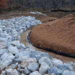
Once all permitting is completed, invasive plant species management will begin. Earth moving then begins to construct a stream channel that meanders within the floodplain, as well as the restoration of the wetlands complex. This is highly detailed work in which the elevations of the stream bed and wetlands are precisely known (+ 0.253 ft. for the streambed and + 0.10 ft. for the wetlands).
Plantings within the area will include more than 20 native species of trees, shrubs, sedges and rushes. Other areas like this that have been converted from wetlands to farmland and then restored back to wetlands have shown that a number of seeds from wetland plant species that were originally there, the seedbank, can and do germinate when conditions are right! It will be interesting to see what might come back following the completion of the project.
Another exciting part of the project is a fish passage at the culvert that allows the stream to flow under Alabama Ave. This will allow for various fish species from Sugar Creek to move back upstream to the restoration area.
If all goes according to plan, the project should be completed in the late fall of 2022, and we look forward to sharing the progress with you along the way.

